Scan through a list of “the world’s most beautiful islands”, and you may not find Taiwan included there. Yet it’s perhaps the only island to have a name – Formosa – that simply means “Beautiful”. According to one oft-repeated story, this arose after Portuguese sailors came across Taiwan in 1542, and on seeing forested coastlines exclaimed “Ilha Formosa!”: “Beautiful Island!0”.
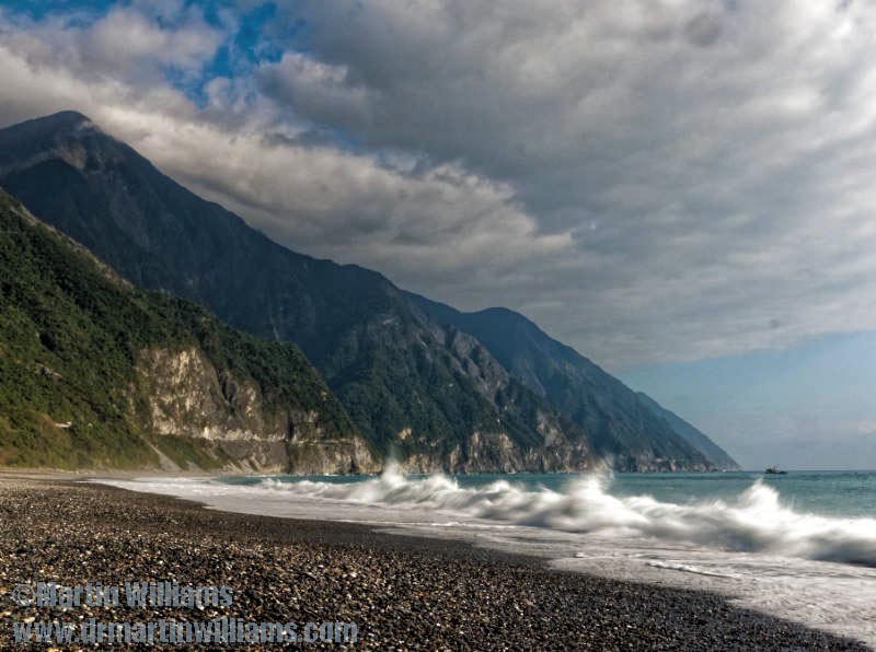
If you only know places like Taipei, it may seem this beauty is long gone. Yet even more than Hong Kong Island, Taiwan is multi-faceted, and for its most stunning coastal scenery you should head to Qingshui (Clear Water) Cliffs, around two-thirds of the way up the east coast.
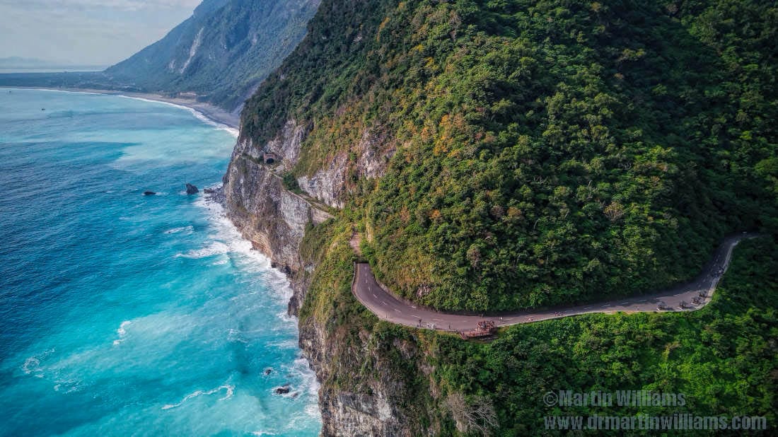
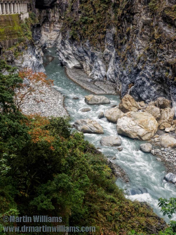
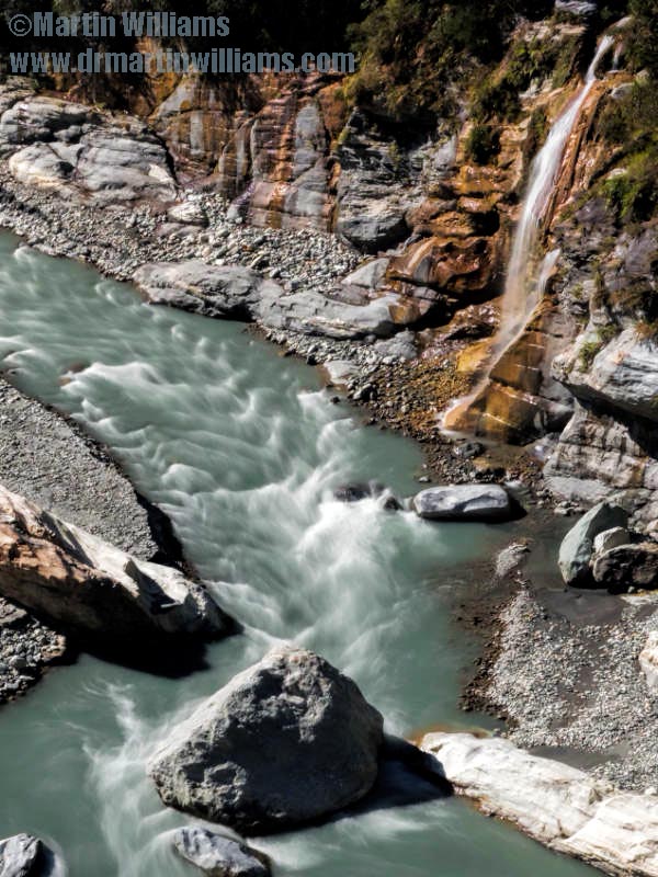
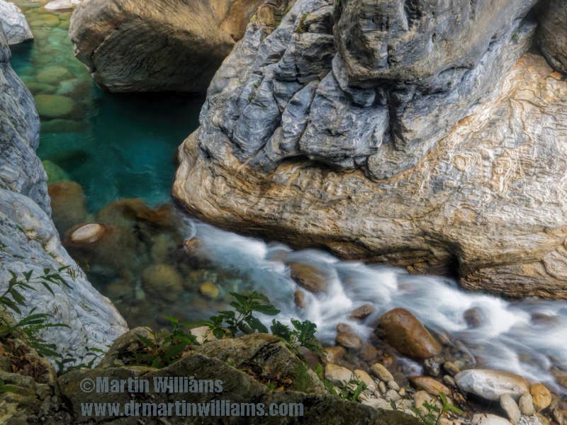
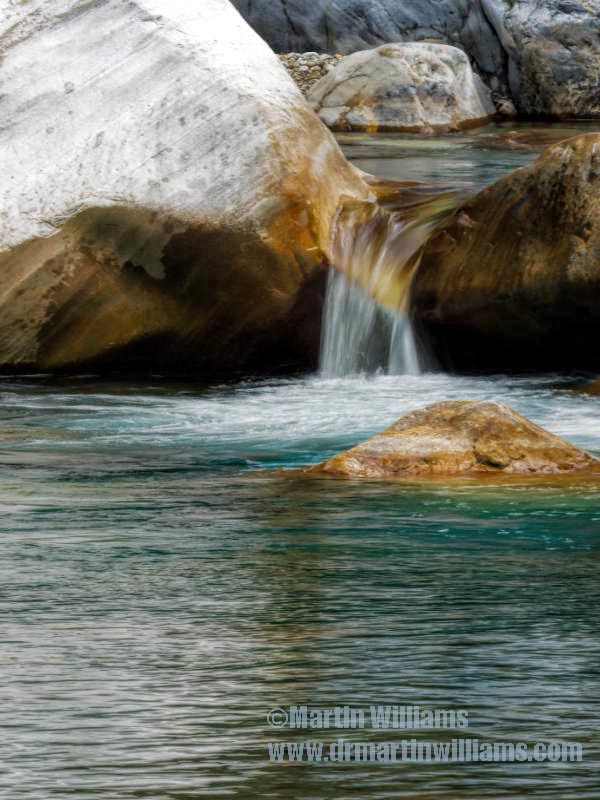
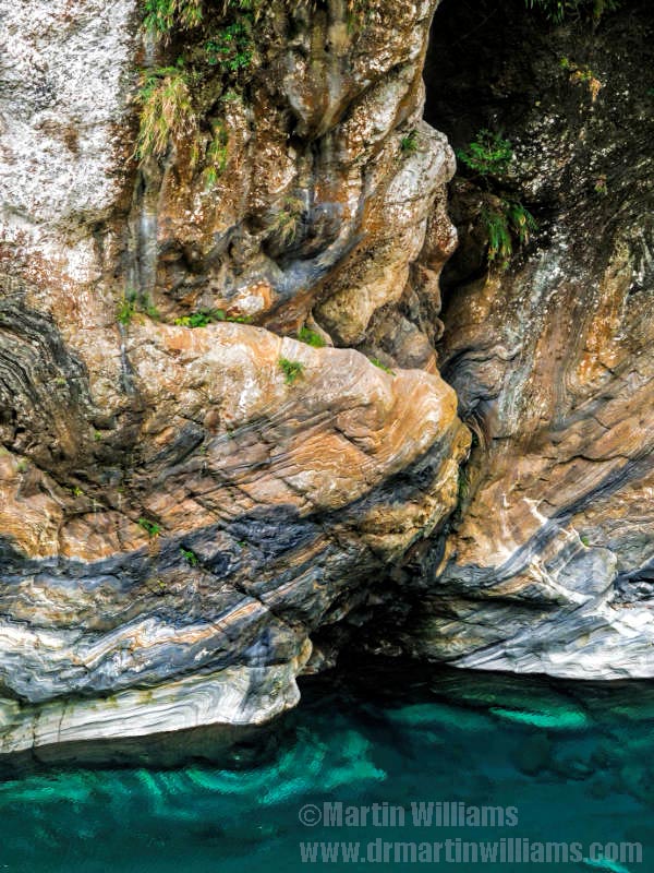
Here, the mountains of central Taiwan plunge to the Pacific Ocean. Steep, verdant hillsides drop from peaks 800 metres and more high, and have been torn away at their bases to form cliffs of pale marble. On a fine, sunny morning the sea is tropical turquoise, turning milkier near the base of the cliffs thanks to calcium carbonate from the eroding rock.
Qingshui Cliffs are in the northeast corner of Taroko National Park, which encompasses a mountainous landscape with an area of some 920 square kilometres – not far short of the 1104 square kilometres of land in Hong Kong. At the heart of the park is the magnificent Taroko Gorge.
Gentle hike to a valley of tranquillity
The entrance to the gorge is in a deep valley that opens onto a narrow coastal plain just south of the cliffs. There’s a national park visitor centre, from where you can take shuttle buses to key locations in the gorge, perhaps to head for one of the hiking trails.
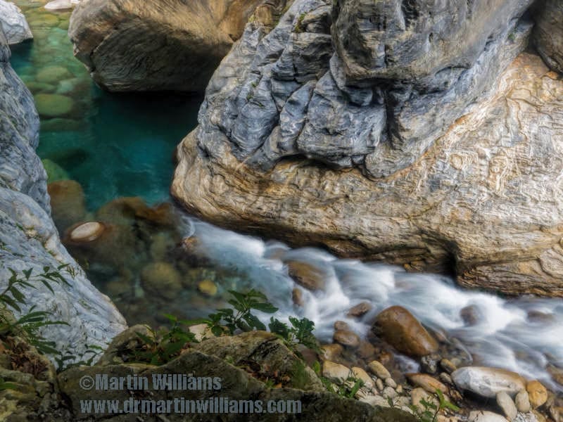
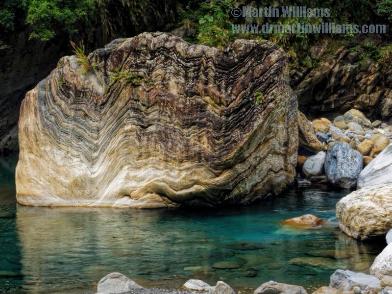
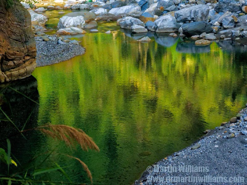
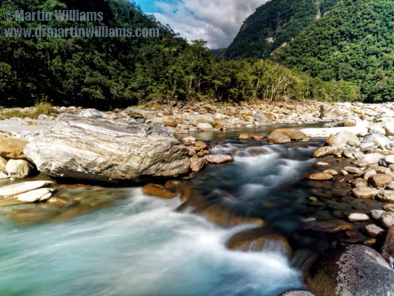
The lowest and most popular of these is the Shakadang Trail. This leads alongside a tributary of the main river, and the early stage has been mostly carved into a cliff, almost forming a tunnel that’s open on one side. The stream makes a wonderful sight, with pools as blue as the nearby ocean, along with waterfalls and cascades.
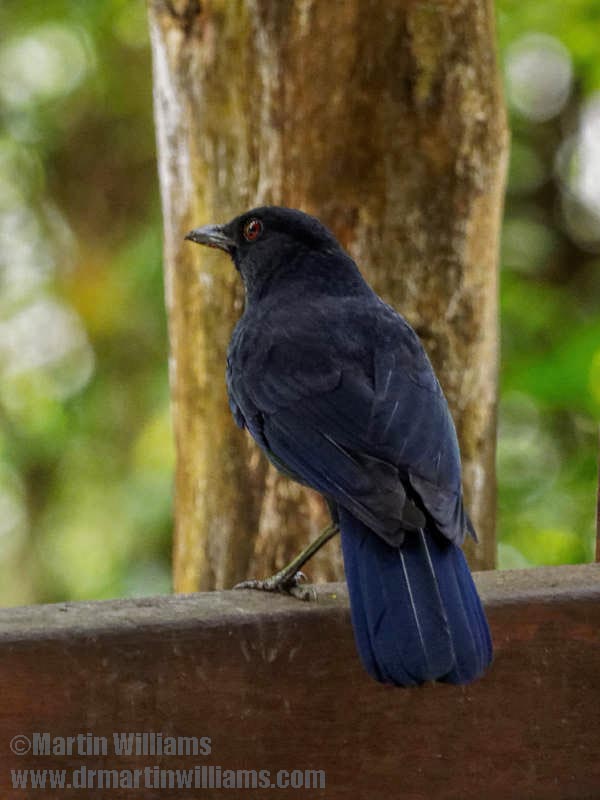
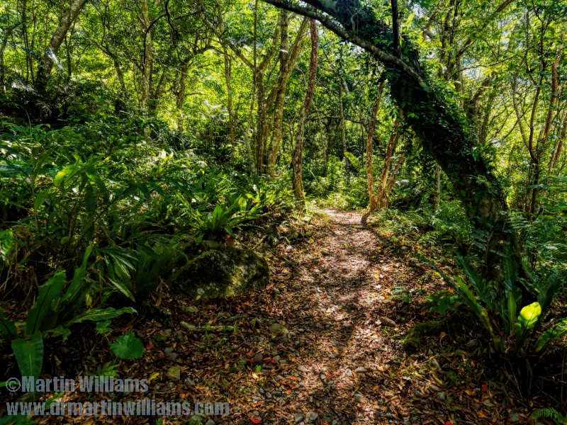
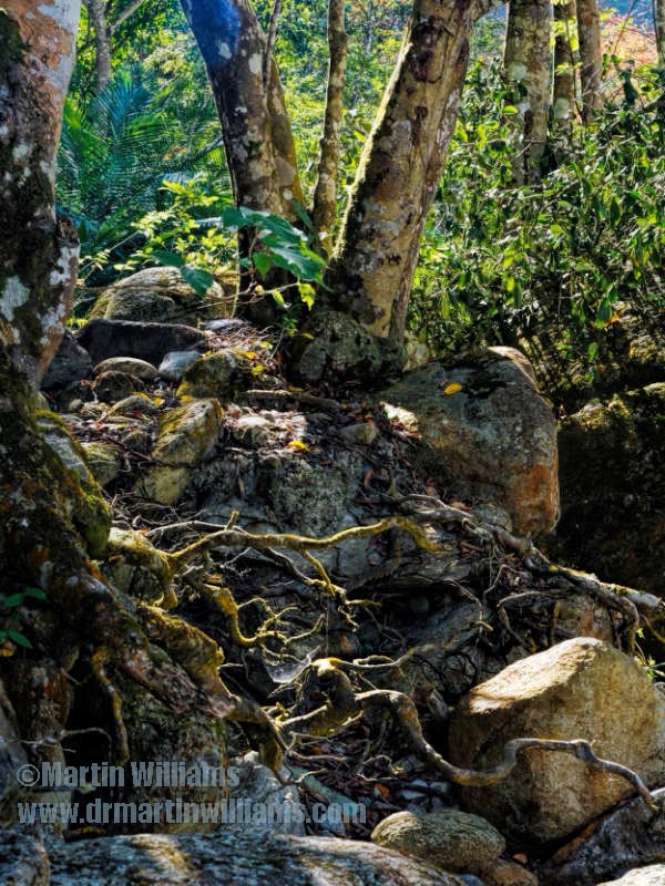
Further into the ravine, the cliffs give way to wooded slopes. Most visitors turn back, satisfied with the main walk through the cliff, but a path continues, following a left turn in the valley, to pass through woodland and arrive by the stream side. This is a glorious place to rest, and admire the natural splendour of wild Taiwan.
Cliffside trails, surging river
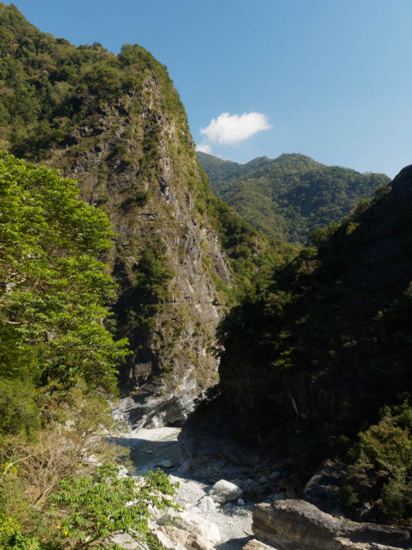
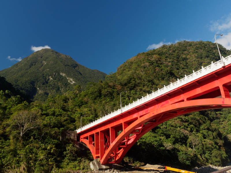
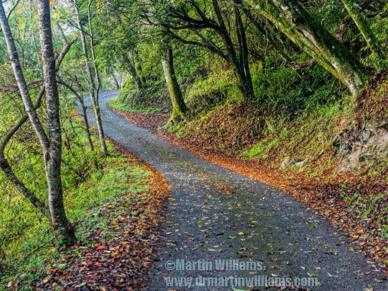
The shuttle buses ply the two-lane road that leads up through the gorge, which heads through tunnels, crosses a couple of bridges, and clings to almost sheer slopes as it winds up into the national park.
Soon after passing the Sakadang Trail, on the right, there’s a suspension bridge across the river. This is only for serious hikers who have a permit to walk what seems to be Taroko Gorge’s signature route: the Zhuilu Old Trail, which climbs steeply, then traverses a cliff face, following a trail hewn from the rock that’s in places less than a metre wide.
An easy walk starts near here, too, along a short stretch of old road through a tunnel with openings that afford views of the gorge and river below.
From a later stop, there’s a chance to walk the Lushui Trail – which is akin to a shorter, safer version of Zhuilu Old Trail, with no need for a permit. It starts with a simple uphill walk, before spectacular stretches where it has been carved along the cliff face. Below, the Liwu River surges between boulders.
What soars above: alpine landscape, and hand-fed sheep
The shuttle bus route ends at Tianxiang, a tiny tourism-focused town some 480 metres above sea level. Yet you can continue up the road, maybe by taxi.
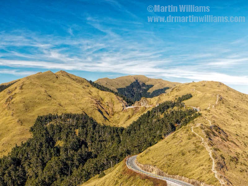
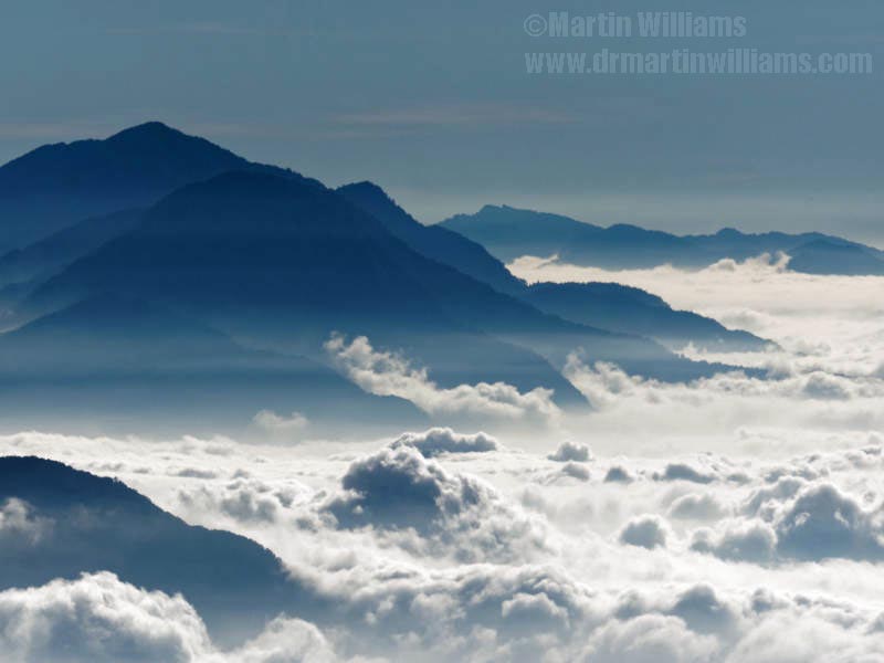
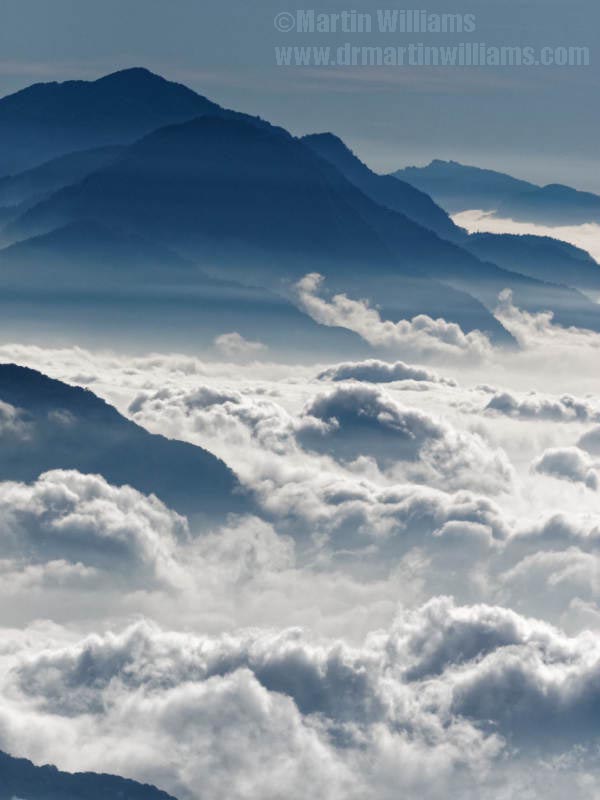
There are more tunnels, hairpin bends, stretches along precipitous hillsides, as the road heads upwards. The landscape becomes alpine, and there’s a stunning mountain landscape, with peaks soaring to over 3,700 metres – four times the height of Tai Mo Shan, maybe with a sea of clouds cloaking the gorge below.
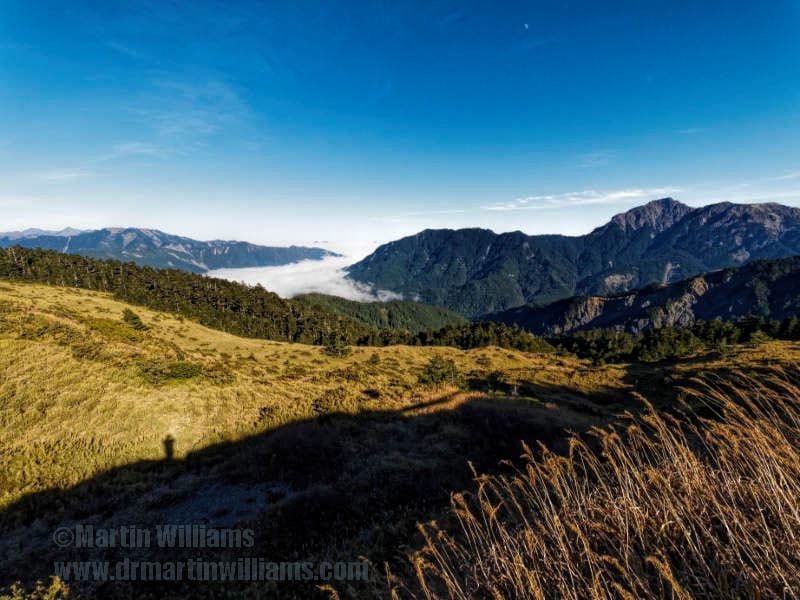
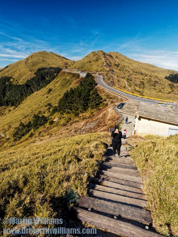
The road reaches a pass at Hehuanshan. Here, a 20-minute climb up a flight of steps leads to the top of 3227-metre Hehuanjianshan, with breathtaking, panoramic views.
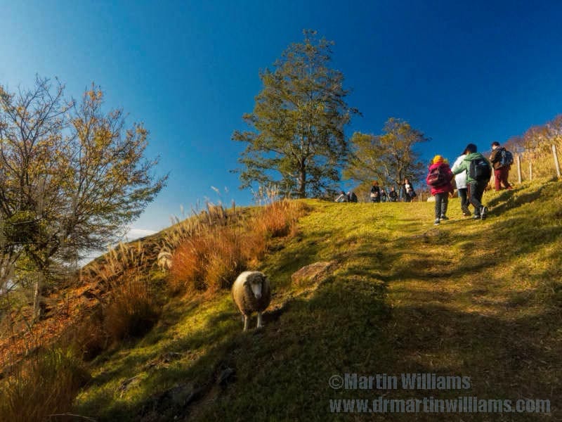
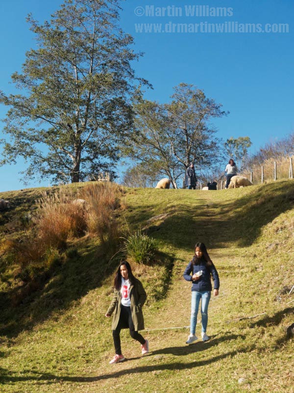
Westwards, the road leaves the national park, and descends through a more rolling landscape. There’s a chance to stop at Qingjing Farm, a popular recreation area with rolling grasslands grazed by plump woolly sheep that tourists are fond of feeding and stroking. Then, down to Taichung city, and a coast with no hills in sight.
旅遊小貼士
Hualien city is at the southern edge of Taroko National Park. While there is accommodation in Hualien, the village of Xincheng is closer to the park visitor centre, and has family-run bed and breakfast places including Xincheng Old Street [where we stayed; liked it]. The park website has information including on obtaining hiking permits, and whether any trails are closed.